The South African Weather Service (SAWS) has issued a stern advisory ahead of a week-long cold snap expected to grip much of the country starting Monday, 19 May. The forecast includes freezing temperatures, gale-force winds, heavy rainfall, and even snowfall in high-lying regions — painting a wintry picture that many South Africans might not be fully prepared for.
The weather chaos will be driven by two cold frontal systems, the first of which is expected to make landfall on Monday in the south-western parts of the Western Cape. This initial front will usher in wet, windy, and chilly conditions — setting the stage for a significantly stronger second front set to arrive on Tuesday, 20 May.
According to SAWS, the second system is expected to have a broader reach, affecting the Namakwa District, Northern Cape, and Eastern Cape, with its grip tightening across other provinces as the week progresses.
Rain, Snow, and Risk: Key Weather Impacts This Week
SAWS has laid out several key hazards that South Africans should brace for:
- Rainfall Accumulations: Between 15mm and 25mm in most areas, with mountainous regions receiving up to 50mm.
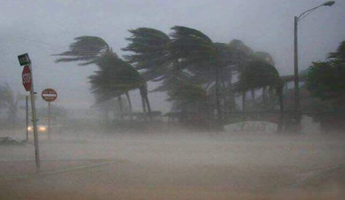
- Strong to Gale-Force Winds: Wind speeds could range between 55km/h and 75km/h, especially over the interior regions of the Western Cape, Northern Cape, and Eastern Cape.
- Snowfall: Expected over high-lying areas, particularly from Tuesday evening, as freezing levels plummet.
- Widespread Cold Temperatures: A general drop in temperatures will spread eastwards throughout the week.
- Localised Flooding: Low-lying and poorly drained areas are at risk of water accumulation and flash flooding.
- Infrastructure Strain: Power outages, disrupted outdoor events, and damage to exposed infrastructure are likely.
In a country where winter tends to sneak in rather than march in with a drumbeat, this cold front combo might come as a rude awakening. SAWS warned that high-sided vehicles, especially trucks and freight haulers, should exercise caution on national roads due to the wind risk. The advisory also mentioned potential travel delays, especially for long-distance commuters and transport operators.
Coastal Areas Face Maritime Hazards
For coastal regions, especially along the south-eastern coastline, the marine forecast is equally sobering. SAWS expects:
- Gale-force Winds: Particularly intense from Alexander Bay to Plettenberg Bay on Tuesday and Wednesday.
- Very Rough Seas: Conditions are expected to deteriorate rapidly, with wave heights reaching up to 7 metres.
- Abnormal Waves: Increased risk of dangerous waves along coastal towns, potentially affecting small vessels and seaside infrastructure.
Maritime operators, fishing communities, and coastal residents are urged to stay informed and prepare for interruptions.
Stay Safe and Stay Warm
While the forecast might make for an exciting snow photo opportunity or an excuse to stay under a blanket, it’s important not to underestimate the seriousness of this system. The combination of freezing temperatures, snow, wind, and rain can have real-life consequences, particularly for vulnerable communities, informal settlements, and essential infrastructure.
South Africans are urged to monitor updates from SAWS, avoid unnecessary travel during peak storm periods, and take steps to weather-proof homes, secure loose items, and assist at-risk individuals where possible.
This week might test the country’s winter readiness — and whether your wardrobe includes more than one thick jacket.